India’s eastern Indus glaciers are melting faster than Pakistan’s and that will reduce water availability after mid-century, leading glaciologist at IISc Anil Kulkarni tells The Indian Express in an interview
Glaciologist Anil V Kulkarni, distinguished scientist, Divecha Center for Climate Change, Indian Institute of Science, Bengaluru.
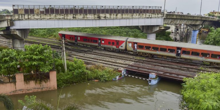
Last week, India put in abeyance the 65-year old Indus Water Treaty following the Pahalgam terror attack that killed 26 people. The treaty divided the waters of six rivers – Ravi, Beas, Sutlej, Jhelum, Indus and Chenab – flowing from the Indus river basin, between India and Pakistan. The Indian government’s move has raised speculations on the strategic steps it could take to utilize water not apportioned to it under the treaty.
While those decisions take shape, the issue has also brought into focus the vulnerabilities faced by the Indus river basin, which is facing loss of glaciers due to climate change.
The Indian Express spoke to leading glaciologist Anil V Kulkarni, distinguished scientist, Divecha Center for Climate Change, Indian Institute of Science, Bengaluru, on the studies he has undertaken on the impacts of climate change on the important water tower of South Asia. Edited excerpts.
India has put the 65-year old Indus water treaty in abeyance. You have been studying impacts of climate change on this river basin. Could you tell us exactly what is happening, and how will it impact water flows in the basin?
First important thing is, in order to understand how flows have changed, we need to understand how climate is changing in the mountains, and how much is the glacier-stored water that feeds the river basin.
Even though the original treaty says that 20 percent of water is allotted to India, if you really look into the amount of glacial-stored water in say eastern river basins, it is not 20 percent but only 5%, and 95 percent of glacier water is stored in the western river basins. That means, there is a fundamental difference in the total availability of water.
Then, we have to understand how climate change is taking place in the mountains. As we go higher in the mountain, the temperature rise is higher compared to the global mean.
Because of that, the glaciers are responding and they are retreating. This retreat depends on the difference between how much snow and ice the glaciers receive and how much they snow and ice is lost to melting in summers, this is known as mass balance. If this is negative, which means there is more loss of snow and ice than gain, the glaciers will retreat.
The glaciers located on the eastern side, that means above Sutlej, Beas and Ravi River, are located at relatively lower altitude, they are losing mass at a higher rate, thus retreating faster. As you go higher, in the Karakoram mountain ranges, glaciers in Karakoram are not losing mass, they are relatively stable. In the scientific community it is called the Karakoram anomaly.
Thus, if we see it on the whole, the western river basins (part of the Indus basin) has a much higher glacier-stored water, and glaciers have not started melting significantly, as compared to the eastern river basins. This differential loss of glaciers and glacier-stored water is going to significantly affect future distribution of water across the eastern and western river basins.
What studies have been done to map flows and water availability?
We have done modelling studies to understand how glaciers are going to change in the future, and how this will affect water availability. We have extensively studied the Sutlej river basin. Our models suggest that due to climate change, glaciers are melting at a higher rate, and so the amount of water coming from glacial melt is much higher than previous decades. This will continue till the middle of the century.
After the middle of the century, water availability will significantly reduce and water from glaciers will be almost negligible by the end of century, if the present trends of climate change hold. This will also apply to other eastern rivers.
The situation, though, is different in western river basins. The glacier-stored water there is higher and their contribution on stream run-off is higher. But, the glaciers there have not started to melt significantly. This luxury, though, will only last till the middle of the century, as per modelling studies, and then a significant amount of glacial melt will start from the middle of the century. This will continue for a longer period, because the glaciers are bigger there, the store of water is higher. As a result, eastern river basins will see reduced water supply from glaciers, and western river basins will see increased water supply. This will alter the amount of water available to both countries. We need to look into this issue more critically to understand it better
How can India use eastern rivers differently, for instance flushing of waters from reservoirs?
In flushing, the idea is to flush out sediments, mud. In valleys, where generally there is high velocity, the sediments will not settle. However, as the water reaches the plains, the mud settles in the river bed, so it is a double-edged sword. You cannot allow that to happen because eventually you need to flush that out too, else it increases vulnerability to floods. In Pakistan, it may affect their canals, and their storage capacity.
Even before the treaty was suspended, experts had talked of redrawing it, especially in the face of climate change. What would be the best way to tweak it to adapt to today’s ground realities?
In the 1960’s when this treaty was written, nobody had an idea about glacier covers or snow cover. This data started coming from the beginning of this century when satellite sensors produced good data. Hence, the treaty was written without a better understanding of the basin, that was a fundamental lacunae. Now we are aware of the changes in runoffs and the original proportion of water allotted can get disturbed.
There will be a change in precipitation. There is no clarity on how it will change but there is a clarity on how temperatures and glacier water is going to change in future. These factors will affect water availability in these regions. So definitely the treaty needs a relook so that regional allocation is maintained.
What are the fundamental causes for glacier retreat, change in snowfall?
The Himalayan region is experiencing a higher rise in temperatures, compared to global mean. Another reason is the change in precipitation. The amount of solid precipitation, in the form of snow, is reducing, and the amount of liquid precipitation in the form of rain is increasing. Even though there is no significant change in a total amount of precipitation, the solid component is significantly reduced. That is the effect of climate change, and particularly so in a low altitude region, rather than high altitude. That is causing most of the glaciers to retreat.
Another change we have seen is melting of snow early in the season. It has changed the seasonality of water availability. That means that instead of May or June, the snow melt water is available in April. This reduces soil moisture, impacts forest fire season. Secondly, with early melting of snow, mountain springs begin to dry earlier, thus there is a significant change in the overall ecosystem of mountains.
Source link : View Article